Saturday, July 5, 2014

Mt. Rainier 4th of July

Even before my first attempt on Rainier, another SAC member and I had planned a July 4th climb on Rainier. Since I'd successfully summited a few weeks earlier and learned the route, I felt comfortable leading our attempt. 

Noel and I opted for the same itinerary that Peter, Greg, and I had used previously. We left after work on Thursday, spent the night in the Paradise parking lot, then woke up early Friday morning, the 4th, to begin our climb. We hadn't reserved climbing permits, so at 7 am, we were the first ones in line, hoping for permits for two nights at Camp Muir. We were a little nervous we wouldn't get the permits we wanted because of the holiday weekend, but there turned out to be plenty left (though I'm sure they got taken quickly Friday morning). 
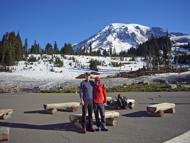
2014 0704 Mt Rainier (3)

We took a parting photo, then set off for Muir around 7.30 am. With great weather and firm snow, the climbing was relatively easy. Unfortunately, I'd been nursing a cold all week that seemed to reach it's peak on Friday. I had a pretty violent cough and carrying a 50 lb pack left me feeling more tired and sore than usual. Several times, especially near the end of the approach to camp, I had to force myself (and Noel) to stop so I could rest, hydrate, and eat. 

Despite my poor shape, we made relatively good time to Camp Muir, arriving shortly after noon (for the stats people: 4,600 ft ascent over 4.3 miles in 4 hours and 45 minutes). By the time we reached camp, my cough was pretty bad and I was exhausted. A couple other climbers even inquired as to when I developed my couch, trying to ascertain whether I'd developed Acute Mountain Sickness, or perhaps High Altitude Pulmonary Edema. One lady (clearly a mother) gave me a couple throat lozenges that she just happened to keep with her. 

I spent the rest of the afternoon and evening trying to sleep in the public Muir Hut, waking only to eat dinner and make sure I stayed hydrated. Despite the noise from other climbers arriving, cooking, and sorting gear, I managed to get some rest and by the time my alarm went off at 1.30 am, I felt better than I had all week. Noel and I made breakfast, oatmeal, bagels, and tea, then got dressed, finished sorting our gear and headed out of the hut to rope up and begin our trek across the first crevassed glacier.

We took a bit longer getting ready than anticipated and didn't start moving away from camp until 3 am, well behind the masses and guided groups that we were intentionally trying to avoid. I led our two man rope team, which benefited me so I could set the pace and not over work myself, still shaking my cold. We moved steadily, passing a couple of other late departing rope teams as we made our way from Cathedral Gap to the Disappointment Cleaver.

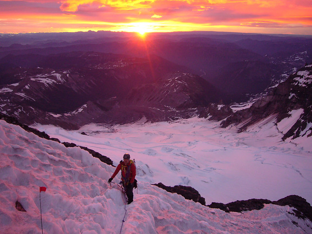
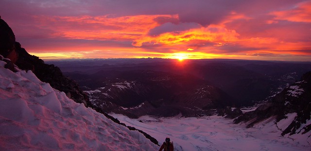
Though the previous day had been perfectly clear and pretty calm, a high layer of clouds had moved in and the forecast called for 60 mph "gale force" winds on the summit. The route was well marked and in excellent condition though and we reached the spine of the Cleaver just before sunrise, my favorite time on the mountain. 

These are not photoshopped...
2014 0704 Mt Rainier (16)_crop

Noel in the alpenglow.
2014 0704 Mt Rainier (18)

Shortly after sunrise, I had to stop for an emergency poo-with-a-view. Noel had to stop traffic in both directions along the route while I did my business in a miniature bergschrund. It's not my favorite thing to do on a mountain, but I certainly felt and climbed better afterwards.

When we reached the top of the Cleaver, around 12,300 ft, we saw the first signs of the fury that lay ahead of us. Climbers on their way down, both that had summited and that had turned around early, were covered in rime ice, in some places up to an inch thick. 

Less than an hour later, we entered the mayhem. Starting at 13,000 feet, the summit of the mountain was engulfed in a lenticular cloud. We were on the leeward side of the mountain, but still fighting through 40 mph winds. Despite the wind, it wasn't particularly cold. I still had an extra jacket and warmer gloves in my pack that I never wore. 

Traversing up the Emmons Glacier seemed very slow. By then, after 7 am, Noel and I were both feeling the effects of the altitude and the climbing. We stopped only a couple of times to seek shelter from the wind, eat a few snacks, and hydrate. 

The last leg of the traverse, which a ranger had warned us about, was nearly half-a-mile long to end run a bergschrund that had formed just below the crater. We spent 40 minutes climbing due west, taking the brunt of the 40+ mph wind and snow directly in the face. We couldn't see more than 30 or 40 feet ahead, so the traverse seemed to go on forever. Even the rope that stretched between us had a thick layer of ice on it. 

When we finally made it to the last turn, we knew we were close to the summit. But the walk across the crater seemed three times as long as my previous, fair weather trip. When we reached the west rim of the crater and entered the full 60+ mph wind, it became difficult to walk. I was nearly blown over a couple of times. 

We couldn't tell by the views, but we did eventually reach the summit at 14,411 ft. After 7 hours of climbing, we'd gained another 4,600 feet over 4.3 miles. 

We stayed on the summit just long enough to take this video.

(Noel is the one whose hand nearly froze off)

When we climbed back down into the crater and got a little shelter from the wind, we recuperated for a few minutes before beginning our descent. We didn't have much time to spare, though, as it was already 10 am and we needed to get back down through the dangerous areas before things warmed up too much and rock and ice started falling. 

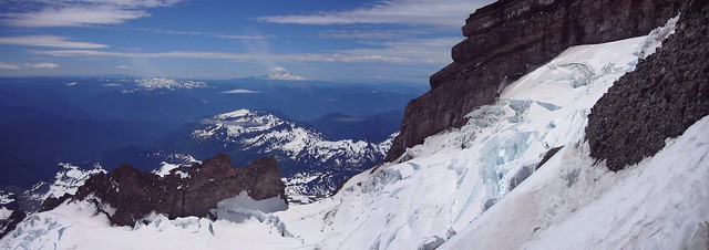
We were both quite relieved when we'd made it back below 13,000 feet and out of the clouds and high winds. We could finally enjoy the views of the mountain under essentially clear blue skies. 

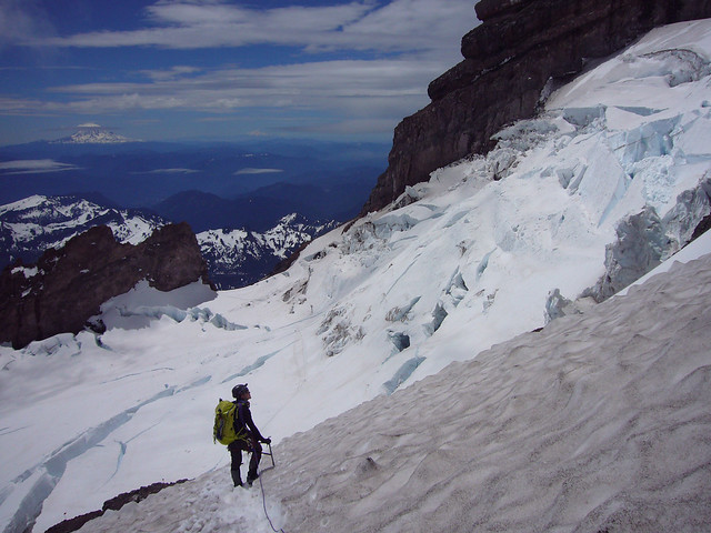
Here's a view across the Ingraham Glacier toward Cathedral Rocks (left) and Cadaver Gap (center) with Mt. Adams in the background.
2014 0704 Mt Rainier (23)_crop

Noel taking in the view.
2014 0704 Mt Rainier (26)_straight

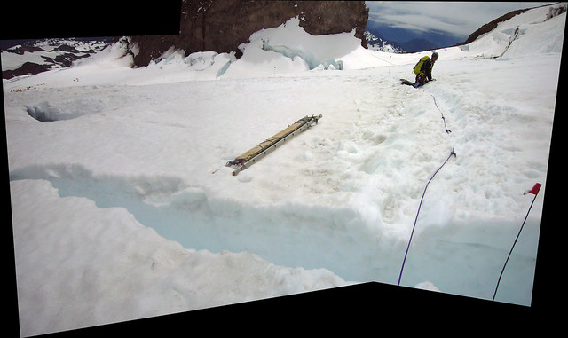
Noel belaying me as I step over a crevasse that will soon required a ladder.
2014 0704 Mt Rainier (30)_stitch

We made it back to Camp Muir just after 1 pm. Though our original plans were to spend Saturday night in the Muir hut and descend Sunday morning, neither of us were enthused with our new, less-than-courteous hut mates, so we decided to pack up and leave Saturday afternoon while the snow was still soft and the plunge stepping would be easy. 

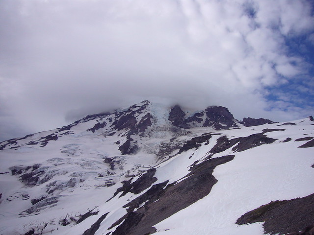
With the thought of a juicy hamburger on our minds, we covered the 4 miles and 4,500 feet back to the Paradise parking lot in an hour-and-a-half. Part way down the Muir Snowfield, we got a great view of what we'd battled through to reach the summit.
2014 0704 Mt Rainier (31)

Despite the poor summit conditions, we had a great climb. Over the two days, we'd covered 16 miles and gained and lost 9,600 ft of elevation.

Saturday, June 7, 2014

Mt. Rainier

Ever since I moved to the Northwest and started climbing, I've wanted to climb Mt. Rainier. It is a quintessential mountaineering peak and the most heavily glaciated peak in the lower 48. This would also be the first mountain I would attempt that required many of the skills I've learned and practiced over the last couple of years, including glacier travel and crevasse rescue (though I would hopefully not have to use that skill).

From the initial planning stage of the climb, it had been coined the "Dream Weekend". We'd picked a time of year that was very likely to have good weather and that the Disappointment Cleaver route, that we were taking, would be in great shape. We had three members on our team, the ideal number for rope team travel in crevasse territory: Peter, our leader had been up the mountain a half-dozen times, Greg, one of the Santiam Alpine Club leaders is a strong climber, though he'd never been up Rainier, and myself.

We also had a plan that would ensure our Dream Weekend would be a good climb. We all took Friday off of work and drove up to the trailhead/Climbing Information Center in Paradise (aptly named) on Thursday evening. We spent the night in the parking lot at 5,400 ft. partly to acclimate and partly to help us get an early start on the mountain in the morning. I rolled out my sleeping pad and bag, stuffed them in my bivy sack and slept quite comfortably on the asphalt.

Our morning view of the mountain from the parking lot.


We woke up around 5 am to have breakfast, pack, and pick up our backcountry camping permits. By 7.30, we were on our way up the mountain. We were on snow from the first step out of the parking lot, which is great, because it's much easier to walk on than the paved or gravel trail we would have otherwise been on. The weather and snow conditions were perfect. It was cool and sunny and the snow was firm, but not icy, allowing for good traction in our mountaineering boots.

Here's Peter leading the way shortly after leaving Paradise.


On the first day, we climbed from the Paradise parking lot at 5,400 ft to Camp Muir at 10,080 ft. We reached camp around 12.30 pm and spent the remainder of the day enjoying the gorgeous weather, napping, and eating.

The larger stone structure is the Muir hut.


Solar toilettes may not smell great, but they are a luxury at 10,000 feet.


After talking with the climbing ranger on Friday evening, we'd decided to start our summit attempt at 2:30 am Saturday morning, after all of the other guided and private groups started (typically12 - 1:30 am). We hoped this would allow plenty of time so that we wouldn't get stuck at the bottleneck spots behind any of the other groups.

That night, Peter and I slept in the Muir hut, a public first-come, first-serve shelter while Greg slept in his tent.


When we woke up at 1.30, we could see a trail of headlamps from the mass of other climbers already slowed down at the first bottleneck, Cathedral Gap.


We ate breakfast, got dressed, and were roped up and on our way up the mountain by 2.30 am. The temperature was below freezing, but the night felt warm and we each soon shed layers to keep from sweating.

Making our way through Cathedral Gap, we passed two separate guides leading down clients that had to turn around. We kept a steady pace, making good time and not taking our first break until we made it to the top of the Disappointment Cleaver, about three hours after we'd left camp. We watched the sun rise as we made our way around the nose of the Cleaver.


We'd made it through the two rocky, bottle-neck sections of the route, and had another 2,000 vertical feet to climb. The rest of the route traversed up a large glacier, winding around large crevasses and going straight over the smaller ones, which we could step over.

Four miles, 4,300 vertical feet, and seven hours after we'd left Camp Muir, we reached the summit.


And the weather couldn't have been any better.


We spent a few minutes relaxing on the summit, but because of our late start couldn't spend too much time up high. We still had to get down through the the Cleaver and Cathedral Gap before the heat of the sun released the rock and ice that was precariously frozen above the route.

Though we were moving quickly, the descent was particularly enjoyable because we could finally see the beauty of the mountain that we'd missed during our ascent in the dark.

Little Tahoma Peak.


Cathedral Rock in the background, Igraham glacier in front, with some massive crevasses the route winds around.


We made it safely back to Camp Muir shortly after noon and spent the next several hours resting and eating. Though our original plan was to spend one more night at Muir, we decided to take advantage of the soft snow and descend all the way to the parking lot Saturday Evening.

Small mountain range just south of Rainier posing for a picture on our descent.


Our total climbing time for the trip was 16 hours, covering 14 miles, and gaining and losing 9,500 feet of elevation.

Peter's plan for the Dream Weekend unfurled to a "T". We had perfect weather, perfect route/snow conditions, and all of us were in good health and fit for the climb. It will be very hard to beat my first trip up Rainier.

I took over 300 pictures. The best of them are on my flickr page.

Friday, May 30, 2014

Mt. Hood - Pearly Gates

To condition for Mt. Rainier, I'd been going to the gym and doing the stair-master for 2 hours at a time with a 50 lb pack and my mountaineering boots on. To get in one real conditioning climb, I decided to solo Mt. Hood via the Pearly Gates the weekend before we left for Rainier.

The Pearly Gates route shares its approach with the Old Chute route, which I've already climbed three times. For the last 500 or so vertical feet, where the climbing becomes technical, the Pearly Gates route goes more directly to the summit, where the Old Chutes skirt to the far left of a series of gullies. I hadn't attempted the Pearly Gates yet because it has a reputation for being "steppy", having sections of steep ice to climb.

On this particular Saturday, the route was in great condition. I left the parking lot just before 2 AM, following a great boot pack all the way up the the Hoogsback. I made good time, stopping only for a couple minutes at a time to eat, drink, and pee.

When I reached the spine of the Hogsback just after 5 AM, the hordes of climbers were all heading left toward the Old Chutes. I was the sole climber that ventured off toward the right and the Pearly Gates. I had to cross the bergschrund, which was really opening up, via a snow bridge. The snow bridge was still solid, especially with the cold morning temps, but would probably be melted out within the next couple of weeks, requiring a large detour to reach the Pearly Gates.


View from just above the bergschrund after crossing it.

To go along with the good conditions of the rest of the climb, the Pearly Gates were in pretty good shape, too. There was only one short, ~25 foot section of hard ice, and it was never steeper than about 45° or so.


Entering the Pearly Gates, the small slot in the middle of the picture.


Climbing up.

By 6 AM, I was standing on the summit, just four hours after I'd left the parking lot. The weather on the summit was prefect; clear skies with no wind. I spent an hour-and-a-half relaxing on the summit and talking with other climbers.

Instead of returning the way I'd come up, I opted to descend via the Old Chutes. The infamous catwalk was narrower and sharper than I'd ever seen it. Normally, it favors one side of the ridge, leaving at least a small amount of snow uphill of you for ice axe placements. Today, however, it was truly knife-edged, with shear drops on either side and barely wide enough for two mountaineering boots. I moved very slowly and deliberately, planting my axe as solidly as possible before each step.


The rest of the descent was uneventful, and I made it back to the parking lot by 10 AM, eight hours round trip, including a nice ling break on the summit, my best climb on Hood yet.


View from the Devil's Kitchen on my way down.

Saturday, April 12, 2014

Mt. St. Helens

Since moving to Portland, I've been told by many people the Mt. St. Helens is a "must climb". I've also been told that while beautiful, it's a pain to climb in the summer when the snow is melted out and much of the climb is on loose scree and volcanic ash. Because of that, I've opted not to climb it during the summer and wait until I had the necessary skills to skin up and snowboard down.

I missed the weather/conditions window last spring, so this spring, it was on the top of my list. Matt Kramer, another member of my climbing club, and I set out on a gorgeous Saturday morning. We started on a dirt trail, splitboards strapped to our packs, but quickly hit snow and were able to convert to ski/skin mode to make our traveling easier. We were both skinning n00bs, but by the time we reached the top of the caldera, I was nearly a pro. We'd asked some more experienced skinners for some tips and found out that with a few key skills we were missing, skinning became much easier.


In the gorgeous weather, we spent an hour or so relaxing on the crater rim. I didn't technically make the  summit because the true summit was heavily corniced and not worth the risk of plummeting to my death.


I'm now convinced that skinning up and ridding down is the best way to tackle snowy mountains.


The rest of the pictures from the trip are on flickr.

Sunday, March 23, 2014

Mt. Hood Old Chutes III

The first few weeks of good weather in a Pacific Northwest spring marks the beginning of alpine climbing season. Near the end of March, I went up Mt. Hood with three other climbers from my climbing club. Little did I know it, but this climb would be the seedling for bigger future climbs. Two of the climbers, Adrian and Peter were training for a Denali expedition in June. The third, Noel, is a newer climber, looking to get into bigger routes.

We climbed the on the South side of Mt. Hood, opting for the Old Chute route, the same one I'd already climbed twice. It was cold, but we had good weather and good snow conditions, so the climb went well. Since it was my first climb of the season, I had a little bit of trouble with the altitude around the Devil's Kitchen and Hogsback, just generally feeling "off". By the time we got to the summit, though, I was feeling well again.


Heading up toward the Old Chute.


Noel, Adrian, and Me just before reaching the summit (in the background).


Left to right: Peter, Adrian, Noel descending the Old Chute.

From this climb, I got an invite on the Denali expedition from Peter and Adrian. Though a Denali expedition is on my bucket list, I couldn't work out the 30+ days off of work I would need. Peter also ended up inviting me on a Mt. Rainier climb, another mountain high on my list. Peter is a very experienced alpine mountaineer and has climbed Rainier several times, so he would be an ideal leader for my first climb on Rainier.