Sunday, May 17, 2015

Mt. Hood Pearly Gates - 5/17/15

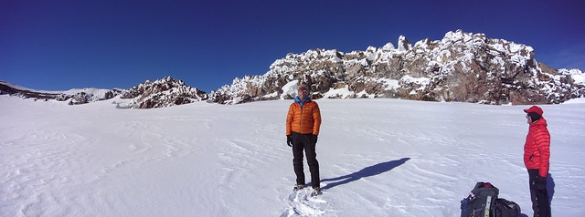
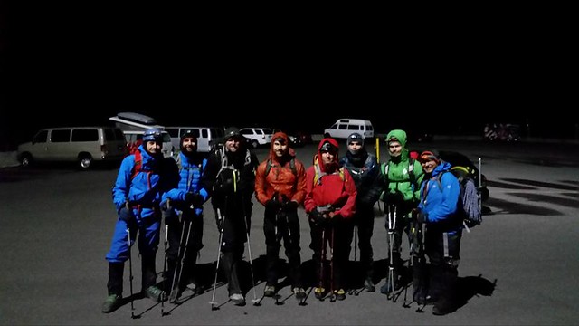
Our team consisted of myself, Gabe Hurley, Adrian Pruncut, Joseph Patrick, Ben Forster, Andy DeGregorio, Jim Green, Matt Licata, and Chris Siller, the latter 4 of whom had never summitted Hood before.

We started our climb under a clear, moonless sky from the Timberline parking lot at 11.45 pm. The outline of the mountain against against a pitch black, starry sky was beautiful and a great reminder of our goal.

2015 0517 Mt. Hood (0)

We started out on a paved path, but quickly hit firm snow, which was a great sign, as we were concerned with the snow conditions we'd encounter higher on the mountain. Other than a stiff wind around 15-20 mph, the weather was perfect, with temperatures in the mid 20s.

For a team of nine, we made pretty good time, reaching the top of the Palmer snowfield in just over three hours. The great snow conditions and reliable bootpack made the slog a bit less miserable and the climb move much quicker.

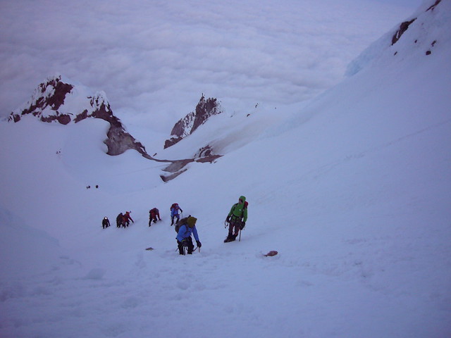
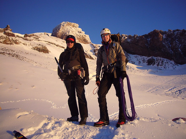
We reached the nauseating fumarole of Devil's Kitchen around 4 am. After donning harnesses and wielding ice axes, we headed up the Hogsback. Because of our early start, only one other group was further up the mountain than us. But while they were heading toward the Old Chutes, our route was through the Pearly Gates. Gabe had beta from a Mazama climb on Friday the the Gates were in great condition.

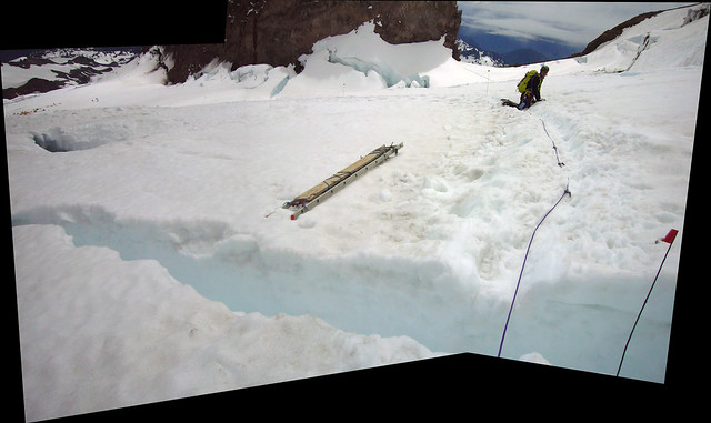
Our only concern was the condition of the Bergschrund. It was wide open and had required stepping across on my previous climb in February. Fortunately, late March & April snows had filled much of it in, so we were able to cross easily on the far right side.

2015 0517 Mt. Hood (5)

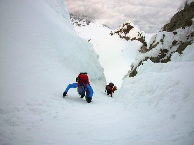
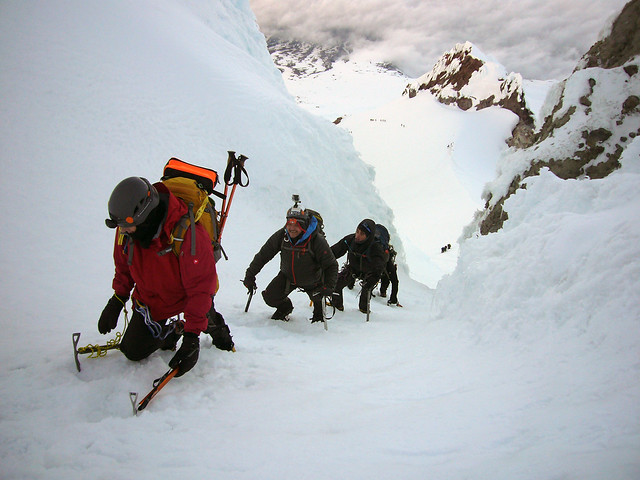
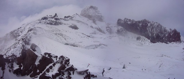
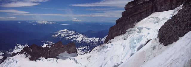
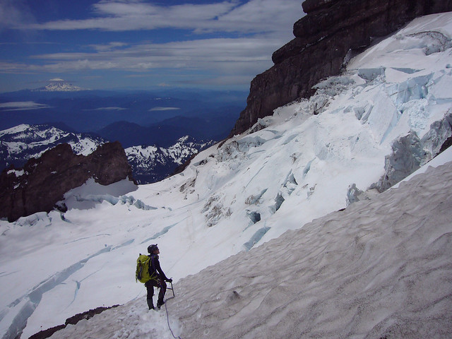
The early start paid off as we made our way up through the Gates around 5 am. First light was just peaking out, illuminating the more technical section of the climb. But, the temperature was still in the 20s, so rock and icefall wasn't a concern.

Everyone had two ice tools, so the whole team made efficient progress through the Pearly Gates. We didn't encounter any hard ice. Some of the snow was airy and thin, but most of it was compact and firm, making for great ax placement.

2015 0517 Mt. Hood (17)

2015 0517 Mt. Hood (25)

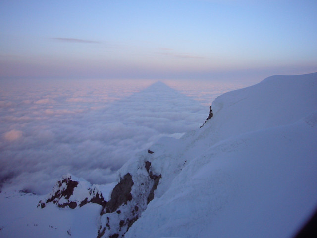
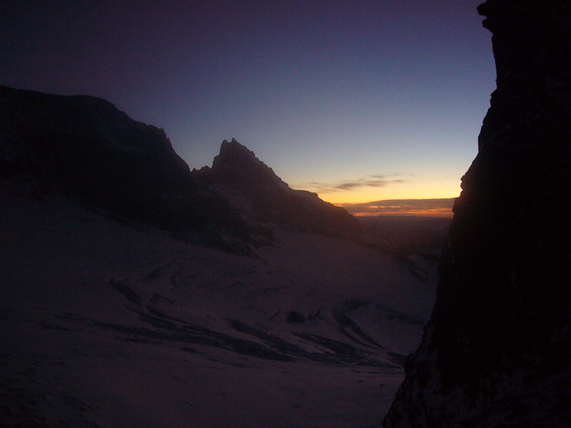
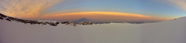
A layer of low clouds still shrouded Portland and made a great backdrop for the mountain shadow.

2015 0517 Mt. Hood (33)

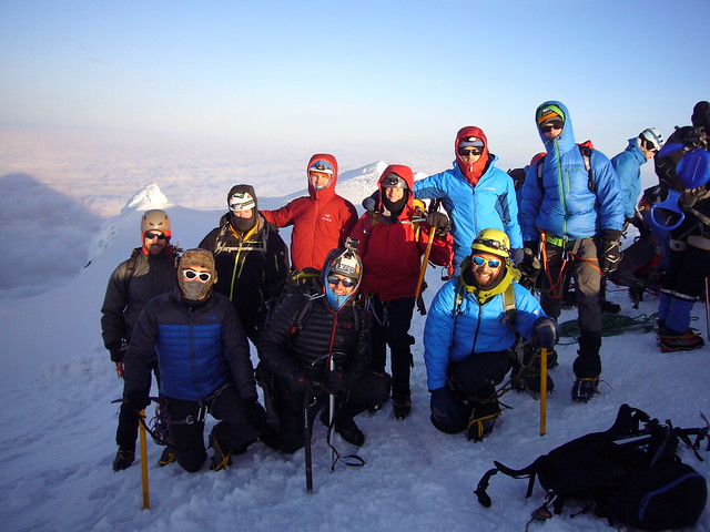
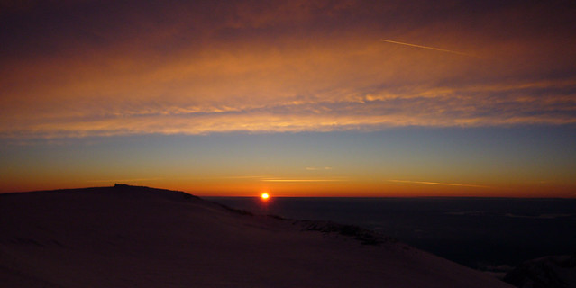
We reached the summit at 6 am, just after sunrise and were the first group to reach the summit that day. Perhaps less of a surprise than it should have been, the second group up (that we had seen heading toward the Old Chutes) was lead by SAC member Mike Wilson! We spent a few minutes on the summit enjoying the views, taking pictures, and snacking, but the stiff wind left us all wanting for warmer temperatures.

2015 0517 Mt. Hood (41)

We decided against descending the Pearly Gates to avoid a potential bottle neck. Gabe planned on scouting the Old Chute, but the catwalk looked to be in particularly poor shape and difficult to self belay on. So, we opted for rappelling down the Mazama Chute.

We placed a picket as a deadman, tied off one end of our 50 meter rope, and were able to rappel all the way out of the chute. Having drawn the short straw, I had to pull the rope and picket and down climb. Traffic in the chutes was starting to pick up, so we were grateful to be heading down the mountain already, thanks again to our early start.

Finally out of the wind and with the sun fully shining, we were all in good spirits as we descended back to Devil's Kitchen.

We made it back to the Timberline parking lot at 10 am, a bit tired, but eager for the beer and burgers that awaited us.

Saturday, September 27, 2014

Mt. Rainier - Camping on the Summit

During the annual SAC Luau, a couple of us talked about climbing Mt. Rainier one more time before the weather got worse. Of course I was interested. It turned out that only Peter and I could make the climb, so we decided to stick to the standard Disappointment Cleaver route, which was likely to have many other people on it, in case something bad happened. We decided to do the route with a twist, though, camping in the summit crater.

Peter was training for Aconcagua in December and climbing high with heavy packs and sleeping at 14,300 feet would be good practice for his trip. And I'm always up for new adventures. We opted for a similar start to our previous trip in June, taking Friday off of work and spending the night in the Paradise parking lot to begin our acclimatization.

The forecast for the weekend was for a mild high pressure system to move over the mountain Saturday and Sunday, with a chance of rain on Friday. We woke Friday morning to steady rain, some of which had seeped through my tent. Luckily, I'd used a spare tent and sleeping bag Thursday night, so my good bag and our tent were dry and ready to go for our climb.

We started out in full rain gear, plastic trash bags pulled over the tops of our packs, around 8 am. The rain had backed off a bit and was relatively light for the first part of the approach. Despite the fact that I'd climbed the mountain two other times this summer the mountain looked totally different. The snow had completely melted on the lower mountain and the valleys we walked through were lush and green. I didn't take much time to appreciate them, though, as we kept moving to get to camp Muir and cover from the rain as quickly as possible.

As we got closer and closer to the ridge and the Muir snowfield, the wind began to pick up until eventually the rain was being driven sideways at us. I'd managed to stay dry for the first several hours, but eventually, rain began to seep through the side zippers on my pants.

Visibility as we moved into the clouds became dismal and the recent snow made route finding challenging. We continued upward in the general direction where we felt camp Muir must be. All the while, we hoped for the driving rain/slush mix to turn to snow and relieve us from the relentless wetness we'd been climbing through for hours. It didn't change until we were almost at camp Muir.

I didn't take my first picture until we made it to camp Muir.
2014 0926 Mt. Rainier (4)_crop

It took us around 5 hours to make it to camp Muir and the shelter of the public hut. The first order of business was to get warm food and rest a bit. Soon after that, we unrolled our sleeping bags to take naps. We both discovered that the trash bags we'd had over our packs had done little to keep our gear dry. Almost everything was wet. I tried to nap for a while in my sleeping bag, but the once lofty down had become soaked and was reduced to cold, clumpy balls, doing little to insulate me. I worried that if my bag didn't dry out, I wouldn't be able to risk spending a night on the summit in the ~10° temperatures.

When I got up later that afternoon, having been unable to sleep. I discovered that the National Park Service workers (who were constructing a new bathroom) had made a barrel fire. Peter and others were already gathered around it drying out various articles of clothing. I brought out my sleeping bag and spent the next two hours holding it next to the barrel attempting to dry out the down as much as possible. It was partially successful and I managed to bring a bit of loft back to the 40 year old bag.

Because Peter and I planned on camping on the summit and didn't need to make it back to camp Muir on Saturday, we had the luxury of planning a relatively late start time. We woke up the next day around 5 am, well after the hordes of other climbers had left between midnight and 2 am.

We were elated to wake up to calm, clear skies and relatively warm temperatures.
2014 0926 Mt. Rainier (6)

We took our time eating breakfast and packing, not roping up to begin the climb until 7 am.
2014 0926 Mt. Rainier (14)

One advantage to the late start was that the groups ahead of us would be breaking the trail. Because of the snowstorm from the previous several days, no one had been on the upper mountain for the last three days. A couple feet of new snow covered the old boot pack. Avalanche concerns were realistic with the fresh snow. On our way up the freshly made trail, the guided groups ahead of us had dug avalanche pits to test the snow's stability on each dangerous slope. The snowpack turned out to be quite stable.

The fresh snow covered the dirty glacial ice and snow, making for beautiful scenery.
2014 0926 Mt. Rainier (16)_stitch

The fresh snow also made the climbing easier. Cathedral Gap and the Disappointment Cleaver, which would have been loose, rocky scrambles a week earlier were now relatively stable and easy to kick steps into.

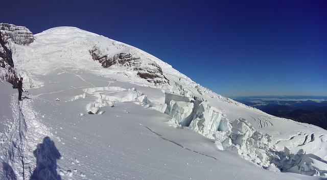
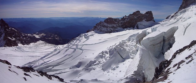
The crevasses had really opened up since my climbs earlier in the year.
2014 0926 Mt. Rainier (24)_crop

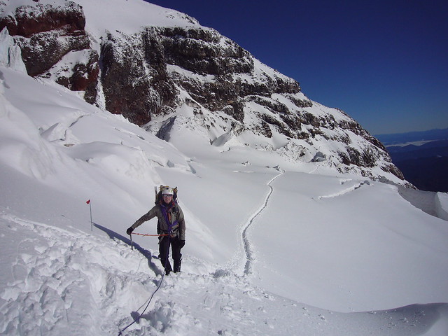
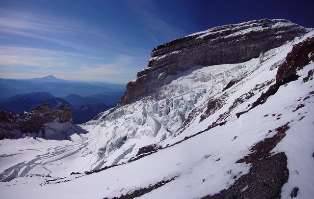
The trail heading towards the Disappointment Cleaver in the background.
2014 0926 Mt. Rainier (31)

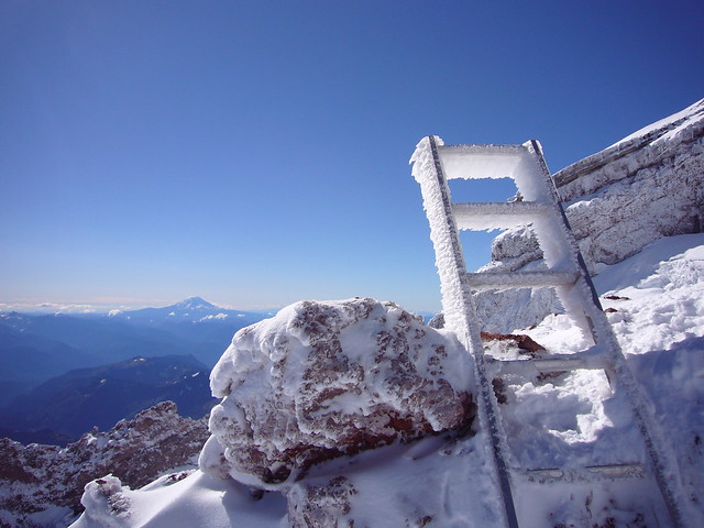
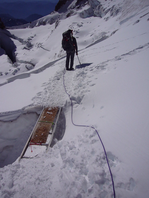
The 6+ inches of rime ice on this ladder give an idea of the conditions we'd climbed through the previous day on our way to camp Muir.
2014 0926 Mt. Rainier (37)

With fully loaded packs (~50 lbs) and a relaxed attitude, it took us nine hours to reach the summit crater, about the same amount of time it typically takes to make the round trip between camp Muir and the summit. As many of the descending groups had told us, there was very little wind "on the summit." When we reached the crater rim, though, we discovered that none of the other climbers had actually reached the summit that day. They'd all stopped on the far side of the crater.

Here's a tricky shot of Peter and I in the summit crater at the site of our new home for the night.
2014 0926 Mt. Rainier (62)_stitch_2

We spent the next couple of hours setting up camp in the snow, melting snow for water, and rehydrating our freeze dried meals. We crawled into our sleeping bags to rest around 6 pm. Five minutes later, I realized that if I wanted to see the sunset from the summit, I'd have to begin the trek immediately. I debated for a couple of minutes, but decided I'd come too far and worked too hard to skip out on the last bit.

The temperature had plummeted since the sun went below the ridgeline (my water bottles were already freezing solid inside the tent). I put on every layer of clothing I had brought, including my new, giant down mittens, then set off for the summit, another 100 vertical feet above us and quarter-of-a-mile away.

Halfway to the summit, I turned around to get one of the best views I've ever had on a mountain. I'd been miserable near the end of the climb to the crater, but this view reminded me exactly why I put myself through such miserable conditions. My pictures don't even begin to do the view justice.
2014 0926 Mt. Rainier (71)_crop
Click on the panorama to make it bigger. You can see the shadow of the mountain cast by the sunset and the little yellow speck that is our tent.

Mt. Rainier still has hot spots, and is venting steam. All the way around the glacier in the crater of the summit, steam vents melt the snow and ice and cause voids underneath it. As I started to cross the edge of the snow to get onto the rocky crater, I could here the snow cracking, like ice on a thinly frozen pond. I was worried about breaking through, so I got down on my hands and knees and crawled the last few feet to the solid ground.

When I finally reach the ridge of the crater that led to the summit, I realized the sun was almost below the horizon. So, at 14,400 feet, after climbing all day, I sprinted the last 50 meters up the ridge to the summit. I've never breathed so hard in my life. But the view was worth it.

2014 0926 Mt. Rainier (88)_crop

I was the only person to stand on the summit of Mt. Rainier that day. Here's my lonely set of footprints to and from the summit (taken in the morning).
2014 0926 Mt. Rainier (141)

After I got back from the summit, Peter got dressed and we headed down under the glacier to explore the ice caves. The aforementioned steam escaping the crater has made a huge network of ice caves. Peter has explored them before and part of our plan of camping on the summit was to have time to explore them again.

The steam flowing through the ice caves made it difficult to take pictures because the flash reflected off of the mist. We took a video instead. We traveled through a couple of narrow passages before reaching a large room and turning around. Where the steam vented out of the ground, the surrounding rocks and air were so hot you couldn't keep a bare hand next to them. The air temperature was probably between 40-50 degrees, 20 or 30 degrees warmer than it was outside.


That night was cold. I slept with all of my layers on and kept a water bottle in my sleeping bag to keep it from freezing. My second bottle froze solid, nearly bursting my Nalgene. I also hadn't managed to dry my sleeping bag completely. There were still clumps of wet down in my bag, which quickly froze and turned into ice balls. I stayed warm by covering the thin spots in my sleeping bag with an extra fleece I'd brought. I'm not sure I slept at all that night, mostly because of the low amount of oxygen in the air at that altitude. Needless to say, I was very happy when the sun finally started to rise.

Again not in a hurry, we waited until the sun rose above the ridge of the crater to really start moving. We ate breakfast, melted snow for water, then packed and headed down from the summit just after 9 am. The first groups of climbers that left camp Muir that morning had already summited.

The climb down was straight forward. We had a good trail and great weather. We stopped for an hour or so at camp Muir to rest, melt a little more snow for water, and eat a little before finishing the trek back to the car.

We enjoyed spectacular views of the mountain, glaciers, and gaping crevasses on the way down.
2014 0926 Mt. Rainier (157)_crop

If you look closely, you can see the trail to the left, below the Ingraham icefall.
2014 0926 Mt. Rainier (149)_crop

Here's a ladder crossing a crevasse.
2014 0926 Mt. Rainier (165)

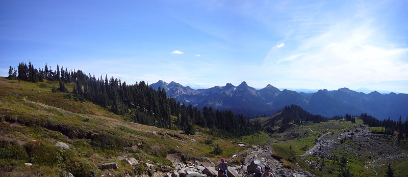
In stark contrast to our ascent on Friday, we had gorgeous weather for the hike out on Sunday. The lower portion of the mountain is beautiful and I was able to see it as I'd never seen it before.
2014 0926 Mt. Rainier (180)_stitch

2014 0926 Mt. Rainier (187)_stitch

The best pictures from the trip are on flickr.

Saturday, July 5, 2014

Mt. Rainier 4th of July

Even before my first attempt on Rainier, another SAC member and I had planned a July 4th climb on Rainier. Since I'd successfully summited a few weeks earlier and learned the route, I felt comfortable leading our attempt. 

Noel and I opted for the same itinerary that Peter, Greg, and I had used previously. We left after work on Thursday, spent the night in the Paradise parking lot, then woke up early Friday morning, the 4th, to begin our climb. We hadn't reserved climbing permits, so at 7 am, we were the first ones in line, hoping for permits for two nights at Camp Muir. We were a little nervous we wouldn't get the permits we wanted because of the holiday weekend, but there turned out to be plenty left (though I'm sure they got taken quickly Friday morning). 

2014 0704 Mt Rainier (3)

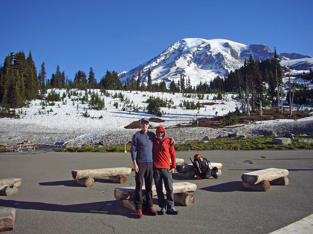
We took a parting photo, then set off for Muir around 7.30 am. With great weather and firm snow, the climbing was relatively easy. Unfortunately, I'd been nursing a cold all week that seemed to reach it's peak on Friday. I had a pretty violent cough and carrying a 50 lb pack left me feeling more tired and sore than usual. Several times, especially near the end of the approach to camp, I had to force myself (and Noel) to stop so I could rest, hydrate, and eat. 

Despite my poor shape, we made relatively good time to Camp Muir, arriving shortly after noon (for the stats people: 4,600 ft ascent over 4.3 miles in 4 hours and 45 minutes). By the time we reached camp, my cough was pretty bad and I was exhausted. A couple other climbers even inquired as to when I developed my couch, trying to ascertain whether I'd developed Acute Mountain Sickness, or perhaps High Altitude Pulmonary Edema. One lady (clearly a mother) gave me a couple throat lozenges that she just happened to keep with her. 

I spent the rest of the afternoon and evening trying to sleep in the public Muir Hut, waking only to eat dinner and make sure I stayed hydrated. Despite the noise from other climbers arriving, cooking, and sorting gear, I managed to get some rest and by the time my alarm went off at 1.30 am, I felt better than I had all week. Noel and I made breakfast, oatmeal, bagels, and tea, then got dressed, finished sorting our gear and headed out of the hut to rope up and begin our trek across the first crevassed glacier.

We took a bit longer getting ready than anticipated and didn't start moving away from camp until 3 am, well behind the masses and guided groups that we were intentionally trying to avoid. I led our two man rope team, which benefited me so I could set the pace and not over work myself, still shaking my cold. We moved steadily, passing a couple of other late departing rope teams as we made our way from Cathedral Gap to the Disappointment Cleaver.

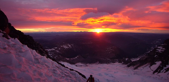
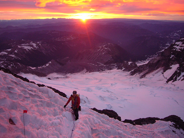
Though the previous day had been perfectly clear and pretty calm, a high layer of clouds had moved in and the forecast called for 60 mph "gale force" winds on the summit. The route was well marked and in excellent condition though and we reached the spine of the Cleaver just before sunrise, my favorite time on the mountain. 

These are not photoshopped...
2014 0704 Mt Rainier (16)_crop

Noel in the alpenglow.
2014 0704 Mt Rainier (18)

Shortly after sunrise, I had to stop for an emergency poo-with-a-view. Noel had to stop traffic in both directions along the route while I did my business in a miniature bergschrund. It's not my favorite thing to do on a mountain, but I certainly felt and climbed better afterwards.

When we reached the top of the Cleaver, around 12,300 ft, we saw the first signs of the fury that lay ahead of us. Climbers on their way down, both that had summited and that had turned around early, were covered in rime ice, in some places up to an inch thick. 

Less than an hour later, we entered the mayhem. Starting at 13,000 feet, the summit of the mountain was engulfed in a lenticular cloud. We were on the leeward side of the mountain, but still fighting through 40 mph winds. Despite the wind, it wasn't particularly cold. I still had an extra jacket and warmer gloves in my pack that I never wore. 

Traversing up the Emmons Glacier seemed very slow. By then, after 7 am, Noel and I were both feeling the effects of the altitude and the climbing. We stopped only a couple of times to seek shelter from the wind, eat a few snacks, and hydrate. 

The last leg of the traverse, which a ranger had warned us about, was nearly half-a-mile long to end run a bergschrund that had formed just below the crater. We spent 40 minutes climbing due west, taking the brunt of the 40+ mph wind and snow directly in the face. We couldn't see more than 30 or 40 feet ahead, so the traverse seemed to go on forever. Even the rope that stretched between us had a thick layer of ice on it. 

When we finally made it to the last turn, we knew we were close to the summit. But the walk across the crater seemed three times as long as my previous, fair weather trip. When we reached the west rim of the crater and entered the full 60+ mph wind, it became difficult to walk. I was nearly blown over a couple of times. 

We couldn't tell by the views, but we did eventually reach the summit at 14,411 ft. After 7 hours of climbing, we'd gained another 4,600 feet over 4.3 miles. 

We stayed on the summit just long enough to take this video.

(Noel is the one whose hand nearly froze off)

When we climbed back down into the crater and got a little shelter from the wind, we recuperated for a few minutes before beginning our descent. We didn't have much time to spare, though, as it was already 10 am and we needed to get back down through the dangerous areas before things warmed up too much and rock and ice started falling. 

We were both quite relieved when we'd made it back below 13,000 feet and out of the clouds and high winds. We could finally enjoy the views of the mountain under essentially clear blue skies. 

Here's a view across the Ingraham Glacier toward Cathedral Rocks (left) and Cadaver Gap (center) with Mt. Adams in the background.
2014 0704 Mt Rainier (23)_crop

Noel taking in the view.
2014 0704 Mt Rainier (26)_straight

Noel belaying me as I step over a crevasse that will soon required a ladder.
2014 0704 Mt Rainier (30)_stitch

We made it back to Camp Muir just after 1 pm. Though our original plans were to spend Saturday night in the Muir hut and descend Sunday morning, neither of us were enthused with our new, less-than-courteous hut mates, so we decided to pack up and leave Saturday afternoon while the snow was still soft and the plunge stepping would be easy. 

With the thought of a juicy hamburger on our minds, we covered the 4 miles and 4,500 feet back to the Paradise parking lot in an hour-and-a-half. Part way down the Muir Snowfield, we got a great view of what we'd battled through to reach the summit.
2014 0704 Mt Rainier (31)

Despite the poor summit conditions, we had a great climb. Over the two days, we'd covered 16 miles and gained and lost 9,600 ft of elevation.

Saturday, June 7, 2014

Mt. Rainier

Ever since I moved to the Northwest and started climbing, I've wanted to climb Mt. Rainier. It is a quintessential mountaineering peak and the most heavily glaciated peak in the lower 48. This would also be the first mountain I would attempt that required many of the skills I've learned and practiced over the last couple of years, including glacier travel and crevasse rescue (though I would hopefully not have to use that skill).

From the initial planning stage of the climb, it had been coined the "Dream Weekend". We'd picked a time of year that was very likely to have good weather and that the Disappointment Cleaver route, that we were taking, would be in great shape. We had three members on our team, the ideal number for rope team travel in crevasse territory: Peter, our leader had been up the mountain a half-dozen times, Greg, one of the Santiam Alpine Club leaders is a strong climber, though he'd never been up Rainier, and myself.

We also had a plan that would ensure our Dream Weekend would be a good climb. We all took Friday off of work and drove up to the trailhead/Climbing Information Center in Paradise (aptly named) on Thursday evening. We spent the night in the parking lot at 5,400 ft. partly to acclimate and partly to help us get an early start on the mountain in the morning. I rolled out my sleeping pad and bag, stuffed them in my bivy sack and slept quite comfortably on the asphalt.

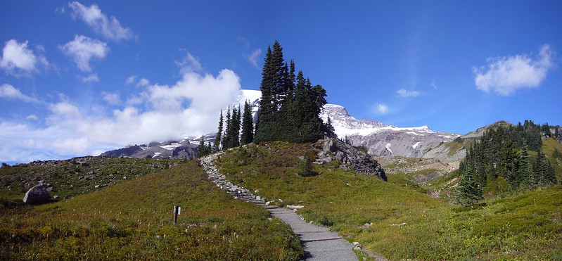
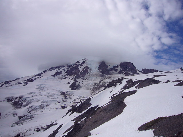
Our morning view of the mountain from the parking lot.


We woke up around 5 am to have breakfast, pack, and pick up our backcountry camping permits. By 7.30, we were on our way up the mountain. We were on snow from the first step out of the parking lot, which is great, because it's much easier to walk on than the paved or gravel trail we would have otherwise been on. The weather and snow conditions were perfect. It was cool and sunny and the snow was firm, but not icy, allowing for good traction in our mountaineering boots.

Here's Peter leading the way shortly after leaving Paradise.


On the first day, we climbed from the Paradise parking lot at 5,400 ft to Camp Muir at 10,080 ft. We reached camp around 12.30 pm and spent the remainder of the day enjoying the gorgeous weather, napping, and eating.

The larger stone structure is the Muir hut.


Solar toilettes may not smell great, but they are a luxury at 10,000 feet.


After talking with the climbing ranger on Friday evening, we'd decided to start our summit attempt at 2:30 am Saturday morning, after all of the other guided and private groups started (typically12 - 1:30 am). We hoped this would allow plenty of time so that we wouldn't get stuck at the bottleneck spots behind any of the other groups.

That night, Peter and I slept in the Muir hut, a public first-come, first-serve shelter while Greg slept in his tent.


When we woke up at 1.30, we could see a trail of headlamps from the mass of other climbers already slowed down at the first bottleneck, Cathedral Gap.


We ate breakfast, got dressed, and were roped up and on our way up the mountain by 2.30 am. The temperature was below freezing, but the night felt warm and we each soon shed layers to keep from sweating.

Making our way through Cathedral Gap, we passed two separate guides leading down clients that had to turn around. We kept a steady pace, making good time and not taking our first break until we made it to the top of the Disappointment Cleaver, about three hours after we'd left camp. We watched the sun rise as we made our way around the nose of the Cleaver.


We'd made it through the two rocky, bottle-neck sections of the route, and had another 2,000 vertical feet to climb. The rest of the route traversed up a large glacier, winding around large crevasses and going straight over the smaller ones, which we could step over.

Four miles, 4,300 vertical feet, and seven hours after we'd left Camp Muir, we reached the summit.


And the weather couldn't have been any better.


We spent a few minutes relaxing on the summit, but because of our late start couldn't spend too much time up high. We still had to get down through the the Cleaver and Cathedral Gap before the heat of the sun released the rock and ice that was precariously frozen above the route.

Though we were moving quickly, the descent was particularly enjoyable because we could finally see the beauty of the mountain that we'd missed during our ascent in the dark.

Little Tahoma Peak.


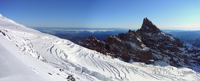
Cathedral Rock in the background, Igraham glacier in front, with some massive crevasses the route winds around.


We made it safely back to Camp Muir shortly after noon and spent the next several hours resting and eating. Though our original plan was to spend one more night at Muir, we decided to take advantage of the soft snow and descend all the way to the parking lot Saturday Evening.

Small mountain range just south of Rainier posing for a picture on our descent.


Our total climbing time for the trip was 16 hours, covering 14 miles, and gaining and losing 9,500 feet of elevation.

Peter's plan for the Dream Weekend unfurled to a "T". We had perfect weather, perfect route/snow conditions, and all of us were in good health and fit for the climb. It will be very hard to beat my first trip up Rainier.

I took over 300 pictures. The best of them are on my flickr page.

Friday, May 30, 2014

Mt. Hood - Pearly Gates

To condition for Mt. Rainier, I'd been going to the gym and doing the stair-master for 2 hours at a time with a 50 lb pack and my mountaineering boots on. To get in one real conditioning climb, I decided to solo Mt. Hood via the Pearly Gates the weekend before we left for Rainier.

The Pearly Gates route shares its approach with the Old Chute route, which I've already climbed three times. For the last 500 or so vertical feet, where the climbing becomes technical, the Pearly Gates route goes more directly to the summit, where the Old Chutes skirt to the far left of a series of gullies. I hadn't attempted the Pearly Gates yet because it has a reputation for being "steppy", having sections of steep ice to climb.

On this particular Saturday, the route was in great condition. I left the parking lot just before 2 AM, following a great boot pack all the way up the the Hoogsback. I made good time, stopping only for a couple minutes at a time to eat, drink, and pee.

When I reached the spine of the Hogsback just after 5 AM, the hordes of climbers were all heading left toward the Old Chutes. I was the sole climber that ventured off toward the right and the Pearly Gates. I had to cross the bergschrund, which was really opening up, via a snow bridge. The snow bridge was still solid, especially with the cold morning temps, but would probably be melted out within the next couple of weeks, requiring a large detour to reach the Pearly Gates.


View from just above the bergschrund after crossing it.

To go along with the good conditions of the rest of the climb, the Pearly Gates were in pretty good shape, too. There was only one short, ~25 foot section of hard ice, and it was never steeper than about 45° or so.


Entering the Pearly Gates, the small slot in the middle of the picture.


Climbing up.

By 6 AM, I was standing on the summit, just four hours after I'd left the parking lot. The weather on the summit was prefect; clear skies with no wind. I spent an hour-and-a-half relaxing on the summit and talking with other climbers.

Instead of returning the way I'd come up, I opted to descend via the Old Chutes. The infamous catwalk was narrower and sharper than I'd ever seen it. Normally, it favors one side of the ridge, leaving at least a small amount of snow uphill of you for ice axe placements. Today, however, it was truly knife-edged, with shear drops on either side and barely wide enough for two mountaineering boots. I moved very slowly and deliberately, planting my axe as solidly as possible before each step.


The rest of the descent was uneventful, and I made it back to the parking lot by 10 AM, eight hours round trip, including a nice ling break on the summit, my best climb on Hood yet.


View from the Devil's Kitchen on my way down.

Saturday, April 12, 2014

Mt. St. Helens

Since moving to Portland, I've been told by many people the Mt. St. Helens is a "must climb". I've also been told that while beautiful, it's a pain to climb in the summer when the snow is melted out and much of the climb is on loose scree and volcanic ash. Because of that, I've opted not to climb it during the summer and wait until I had the necessary skills to skin up and snowboard down.

I missed the weather/conditions window last spring, so this spring, it was on the top of my list. Matt Kramer, another member of my climbing club, and I set out on a gorgeous Saturday morning. We started on a dirt trail, splitboards strapped to our packs, but quickly hit snow and were able to convert to ski/skin mode to make our traveling easier. We were both skinning n00bs, but by the time we reached the top of the caldera, I was nearly a pro. We'd asked some more experienced skinners for some tips and found out that with a few key skills we were missing, skinning became much easier.


In the gorgeous weather, we spent an hour or so relaxing on the crater rim. I didn't technically make the  summit because the true summit was heavily corniced and not worth the risk of plummeting to my death.


I'm now convinced that skinning up and ridding down is the best way to tackle snowy mountains.


The rest of the pictures from the trip are on flickr.

Sunday, March 23, 2014

Mt. Hood Old Chutes III

The first few weeks of good weather in a Pacific Northwest spring marks the beginning of alpine climbing season. Near the end of March, I went up Mt. Hood with three other climbers from my climbing club. Little did I know it, but this climb would be the seedling for bigger future climbs. Two of the climbers, Adrian and Peter were training for a Denali expedition in June. The third, Noel, is a newer climber, looking to get into bigger routes.

We climbed the on the South side of Mt. Hood, opting for the Old Chute route, the same one I'd already climbed twice. It was cold, but we had good weather and good snow conditions, so the climb went well. Since it was my first climb of the season, I had a little bit of trouble with the altitude around the Devil's Kitchen and Hogsback, just generally feeling "off". By the time we got to the summit, though, I was feeling well again.


Heading up toward the Old Chute.


Noel, Adrian, and Me just before reaching the summit (in the background).


Left to right: Peter, Adrian, Noel descending the Old Chute.

From this climb, I got an invite on the Denali expedition from Peter and Adrian. Though a Denali expedition is on my bucket list, I couldn't work out the 30+ days off of work I would need. Peter also ended up inviting me on a Mt. Rainier climb, another mountain high on my list. Peter is a very experienced alpine mountaineer and has climbed Rainier several times, so he would be an ideal leader for my first climb on Rainier.

Friday, March 14, 2014

Winter and Surgery

It's been a while since I posted mostly because I haven't been too active. After the Wolf Rock adventure, winter came to Portland and ended the dry climbing season. Shortly after Wolf Rock, I discovered an umbilical hernia. I kept climbing indoors and playing soccer though. I didn't experience any pain. I just had to push the tissue back in every once in a while

For Christmas, my family went to Colorado to ski/snowboard. We had great conditions (cold and snowy) but unfortunately only got four days on the mountain. The front end of our trip was interrupted when we discovered a bad leak on the inlet of the water heater. We spent the first night and day going to Denver to buy a new water heater, then installing it. In the process, we discovered the old water heater had been hooked up backwards. We now have great hot water at the cabin.

After Colorado, I headed home to KY with my family. It was the first time I'd spent at home in a year. After discovering my hernia, I decided to have surgery while I was at home so that my dad could set it up and I'd have someone to drive me to and from the hospital. December 31st was the only option, so I had surgery on New Years Eve. Everything went very smoothly and I now have sutures holding the small hole behind my belly button closed. The actual surgery only took 20 minutes and I was only in the hospital for a few hours.

The worst part of the surgery was the recovery. I didn't actually have any pain or weakness, but the surgeon ordered me not to do any physical activity for six weeks. He didn't even want me to run. So I went to the gym every day and did the stair master to stay in shape. That and the weather are the primary reasons I haven't been very active lately. I just started climbing and playing indoor soccer again a few weeks ago.

The days are getting longer now and I'm hoping to start getting some climbing in. Maybe some winter climbs or new routes on Hood.

Sunday, October 20, 2013

Wolf Rock Round II

I'm way behind on updating my blog, but my most recent adventure is one worth writing about right away.

Two weeks ago, one of the climb leaders, Fritz, in my climbing club introduced me to Wolf Rock, a 1,000 foot high monolith a couple hours from Portland. Our first trip down there, with a group of five, was largely exploratory. There are several sport climbing routes on the rock faces, some of them leading all the way to the top of the rock. We decided that day to attempt a route known as "Gigantor" that eventually leads to the top, as we were all interested in working on some multi-pitch rock. It was slow going and we only made it up two of the seven technical pitches before we decided there wasn't enough daylight left and it was time to turn around. After a couple of long rappels, we were back at the car relatively quickly.

The southeast face of Wolf Rock. Our route is just under the Great Roofs on the right edge of the rock.
Wolf Rock (0)

We had fun that day, but not summiting and feeling like we could have had left a bug in us. Incredible, dry, sunny fall weather gave us another chance at that rock yesterday. We decided a small group of competent climbers had the best chance of summiting. Fritz, Ty, and I made up the threesome.

This time, we knew exactly what we were in for and prepared accordingly. We packed light, bringing only the gear we needed, expecting a few hours of climbing, then a relatively easy hour long hike down a different side of the rock and back to the car.

We left the car around 11.30 am and were on the rock by noon. Here are Fritz (in blue) and Ty getting ready for the first pitch.

Wolf Rock (1)

And looking straight up our route, over 500 feet of vertical rock.

Wolf Rock (2)

Fritz led the first pitch, as he had on the previous trip. I belayed him. About half way up the first pitch, Fritz was a foot or so above his last piece of protection when one of his handholds broke, sending a softball sized rock down at Ty and I. I immediately locked off the belay and in a mere instant, Fritz dropped 15 feet before the slack and stretch in the rope arrested his fall. Our adrenaline was definitely flowing now, but everyone was ok, so we continued our climb.

It took us over four hours to get to the top of the second pitch, up about 250-300 feet and as high as high as we'd made it on the first trip. We weren't moving quite as fast as we'd expected. Here's my view while belaying Ty from a small ledge at the second belay position. You can see Fritz at the top of the first pitch.

Wolf Rock (10)

After the first two pitches, which were the longest and most difficult, we began to get a rhythm and move much more efficiently. I would lead the next pitch, quickly set the anchors I had pre-made, then belay up the next climber, who would clean our gear from the route. I'd rest while the third was climbing (and the second was belaying) and the third climber would pull the lower anchor, then climb up to meet us. I'd take the necessary gear and anchors, then set off on the next pitch.

At the top of the third pitch, we knew we were running out of daylight. We had to decide whether to continue up and risk descending an unknown path in the dark, or back off and begin a long, somewhat cumbersome and risky series of rappels back to the base of the wall. We decided that the rappels (statistically the most dangerous part of climbing) were unappetizing and continued upward.

Though the upper pitches were technically less difficult than the first two, they were also not protected as well, meaning the spacing between bolts to clip your rope into as you climbed became significantly larger. Being 20 or 30 feet above the last place you clipped your rope to an anchor would mean roughly a 40 to 60 foot drop if you fell. Each hand and foot placement became critical and I was hyper aware of the importance of not slipping or weighting a loose or broken hold. I checked each piece of rock before placing a foot or hand on it.

Despite the slight nerves, the weather was great, the views were spectacular, and I took the time to enjoy them. Here is our view of the Three Sisters, a trio of volcanoes, two of which I've climbed.

Wolf Rock (24)

And here is Ty traversing under the Great Roofs to meet Fritz and I at the top of the 4th pitch, about 450 feet up the wall.

Wolf Rock (37)_stitch

We had just one more technical pitch to the top of the 500 foot shear wall. I led the pitch, traversing left and up a series of ledgy boulders. I hadn't been eating and drinking enough during the climb and in the middle of one move up onto a large boulder, my left hip cramped and locked up. I was several feet from my last piece of protection and didn't want to take a long fall. Shifting all my weight to my arms and right leg, I quickly relaxed my left leg and waited for the cramp to subside. I spent a couple minutes stretching my hip before continuing, being careful with each move to not put too much force on my left leg.

When we all three topped out the 5th pitch, we saw the climbing got easier (though still class 4/5 rock) and thought we were close to the summit. In reality, we had climbed 600 feet, but still had another 400 feet of scrambling up a rocky ridge to reach the summit. And the sun had just set.

Luckily, we'd made it to the top of the technical section before sunset. It would have been very difficult to make our way up through the rocks and find the small anchors in the dark. At that point, around 7 pm, we had a few options; 1) rappel/down climb the way we had come back to the base of the cliff, 2) find a level spot and stay put for the night, 3) continue up the the summit and find the non technical route down.

Risking a series of rappels that would have been dangerous during the daytime, in total darkness, was out of the question. Fritz and I didn't like the idea of spending the night on the rock, so under the full moon and with headlamps on, we decided to continue upward and search for the easiest route back down.

There was just one problem. Ty hadn't brought a headlamp, fully expecting to be back well before dark. He also only brought prescription sunglasses. When he had to take those off at sunset, he was nearly blind. Fritz and I had to climb closely in front of and behind him, often pointing out exactly where to place a foot or a hand. The going was slow. We made it to the summit ridge around 7.30. We paused for a while to take advantage of the elevation and associated cell phone coverage, contact anyone that might be worried about us, and consult some route descriptions and topographical maps to find the best way down.

We'd climbed the southeast face and needed to get to the southwest gully for our descent. The only way there was to climb along the summit ridge until we got to the west side of the rock. So, at 8.30, despite not necessarily intending to, we summited. There was even a geocache at the top for me to log.

Now, it was just a matter of finding the southwest gully. Easier said than done

Each time we found a gully that looked relatively easy to descend, we decided to climb the ridge on the other side to see what was over there and make sure we'd found the furthest west gully. And each time we did that, we found a gully that looked more promising than the previous one. Though, in the pale moonlight, it was impossible to tell which was the best way down and really see what we were getting into.

When we finally decided to descend one of the gullies, we found a small cairn, a man made pile of rocks used to denote a trail. It was the first bit of good news we'd had in hours and we were ecstatic that it was now only a matter of hours before we'd be back at the car. The way down was very manageable class 3 terrain, though without being able to see, Ty spent most of the descent sliding and crab walking on his butt.

A few hundred feet down the gully, we hit a dead end. But it wasn't a dead end, it was a 40 foot cliff. Though the cairn signified we had found the correct route, the lack of a distinct trail made it too easy for us to get off route. And somehow we had.

We'd gone to a lot of trouble to avoid rappelling in the dark, but now it was our only way down. Of course we had all the gear, so we tied an anchor around a tree and rappelled down into a dry creek bed. The descent from here was relatively easy, with solid boulders offering good foot and handholds.

Until, as our luck would have it, we came to the edge of a 100+ foot waterfall. With headlamps as our only light, we could barely see to the bottom of it, and it was impossible to tell how far down it really went. We tied another anchor around a tree and began the rappel into the abyss. Fritz went first. He reached the end of the rope before he reached solid ground. Our prospects weren't looking good. Luckily, off to his left was a higher platform that he could traverse over to and safely down climb from. Ty and I each rappelled and we continued our trek down the drainage, at this point overgrown with trees and shrubs. We were bushwacking every step of the way down.

Then we hit another waterfall. We couldn't catch a break. This one was smaller, though, and we were able to down climb the steep, muddy slope around it.

Another hour or so of bushwacking... and we ran into the road. A few more minutes of easy walking and we would find the car. Of course it was all up hill. But finally, at 1 am, after another 13 hour Fritz epic, we'd made it back to the car. We were hungry, tired, and dehydrated, but we'd made it back safely and with a story to tell.

The rest of the pictures are here. More to come soon.
Monday, October 7, 2013

Wolf Rock

This is a prequel to the much more exciting story of Wolf Rock. This turned out to be largely a reconnaissance mission. Fritz led me and four other climbers to this great monolith he'd never climbed before but had seen and heard about. We decided to spend a day down there either climbing sport routes or doing a mutli-pitch climb.

None of us had done a lot of multi-pitch climbing but in the car on the way down there, we all decided we'd like to try some out, even if we didn't make it to the summit. We only made it two pitches up the 600 foot face that day, but we had a lot of fun and knew that with better planning, we could make the summit. All this foreshadowed the events of Wolf Rock Round II.

Monday, August 5, 2013

Spartan Race

Before I did a Tough Mudder over the summer, I'd always thought obstacle racing looked like fun. I hate running, but I love being outside, challenging myself, and trying new things. I also have a bit of self described outdoor ADD. So obstacle racing turned out to be a perfect fit for me.

In August, Dante, Brian and I worked as volunteers for a Spartan Race in Washington. That weekend was a Spartan Sprint, which is a short (~5k) race with lots of obstacles. Volunteering got us free race entry. We didn't run the race together like we had during the Tough Mudder. Instead, after the first hill climb, I got in stride and took off. None of the obstacles required teamwork, so I was able to move at my own pace and really push myself.

The race had a lot of challenging obstacles and I thoroughly enjoyed it. I finished the course in just over an hour, significantly slower than racers in the first heat that got to run before the course got muddy, but overall a fast time. I spent about half of that time on one obstacle, trying to crawl under barbed wire up a 100 yard long hill covered in mud that they were constantly spraying down with hoses. Dig fingers in to mud, climb up two feet, slide down one foot (sometimes slide down three feet), repeat. At one point I teamed up with another racer to make better progress up the hill. We'd act as human ladders for each other. One of use would cling to the mud while the other would climb up him. We'd trade positions and keep going. It was tough work, but eventually we made it to the top. We got to slide right back down the hill on a giant water slide, definitely the most fun part of the course.

I managed to keep running during the entire race. Except for one section; carrying this heavy sandbag up a long, steep hill. 
Clearly the guy behind me has the right strategy. I was a rookie for this race. I'll be back.

Sunday, July 28, 2013

Climbing Mt. Adams

A couple of my climbing partners have been training for Mt. Rainier (near Seattle, the most prominent glaciated peak in the lower 48) and were climbing Mt. Adams for training. I was also supposed to be training for Rainier, but I was out of town for their climb dates. When they brought up climbing Mt. Adams, I was instantly on board. By volume, Mt. Adams is the second largest volcano in the Cascade Range and rises to 12,281 ft, with a prominence (height above the surrounding terrain) of 8,117 ft. It is by all measures a large mountain.

Most climbers hike the non technical route halfway up the mountain to a broad shelf known as Lunch Counter in one day, then climb the remaining way to the summit and descend on a second day. Gabe, Jeremy, and I planned a variation of the standard South Spur Route that would include glacier travel, crevasse navigation, and steep snow and ice climbing.

However, when we arrived at the Mt. Adams ranger station Saturday morning, we were informed that the route we'd chosen was closed as it entered seasonally open Indian territory. Also conspiring against us was an oncoming low pressure system and rain forecast for Sunday.

We decided that the summit was our real goal, so we traveled the standard, dog route. We left the trailhead just before 11 am, slightly behind our initial goal. Though it was late June, we hiked less than a mile from the trailhead before hitting snow. The snow was melting in the heat of the afternoon sun, but was firm enough that travel was relatively easy and we made good time.

We made a friend on the way up.
Mt. Adams (1)

By 3.00 pm, we made it to lunch counter, a 3,900 ft climb over four miles. We were tired from carrying heavy packs loaded with technical climbing and overnight gear. However, with rain in the forecast for Sunday, we decided to set up camp, refuel, then make a push for the summit while we had good weather. We still had a few hours of daylight left and decided  a sunset summit would be a great idea.

Unfortunately, the climb from Lunch Counter to Piker's Peak (the false summit) is the longest, steepest section of the climb. It's a sustained slope with sections as steep as 45° that rises 2,000 feet in only one mile. Fortunately, because we were climbing in the evening, the snow on the slope was soft and made for easy steps without crampons. Climbing the frozen slope in the morning would have required crampons and been much more strenuous.

Despite the long day behind us, we made relatively good time up the slope, gaining Piker's Peak in two hours.

From there, a short, slightly downhill hike, then uphill slog gains the summit. This turned out to be the longest part of the day. The altitude and exhaustion were catching up to all of us and our progress slowed. Still, we made reasonable time and gained the summit 45 minutes before sunset. We'd gained 6,900 feet over 5.5 miles in about nine hours. None of us were feeling great and the wind wasn't very friendly, so we took the obligatory summit pictures then began our descent.
Mt. Adams (15)

We took advantage of some glissading to speed our descent, but the conditions were less than ideal. The snow had begun to refreeze, so the glissade paths were hard and fast. Gabe and I both managed to break buckles on our packs and I wore a hole through the mesh on one of my side pockets, nearly sending my Nalgene down the mountain ahead of me. Despite some difficulties, there was some good glissading to be had and the trip back to Lunch Counter and our camp was relatively uneventful.

Except for one thing.

Though I had forgotten, we were climbing on the night of the super moon. And just as the sun was setting, we were treated to the most incredible view of a mountain shadow I've ever seen. The few clouds in the sky gave way to the moon, making for one of the most awe inspiring views I've ever had and one of the best pictures I've ever taken. The view for this shot was only there for a few minutes and I was fortunate to look up and see it and more fortunate still to capture it.
Mt. Adams (26)_HDR1_crop

We made it back to camp just before dark, ate dinner, then promptly climbed into the tent to sleep. When I woke briefly at 3 am, rain was pummeling the tent walls. We'd made the right decision to summit Saturday evening.

Sunday morning came around 6.30 am when we all woke, listening to the rain. It would be a miserable, wet day and our plans to explore the Mazama Headwall and do some technical climbing were instantly cancelled. We took advantage of a lightening rain around 7 to break camp and begin our descent. Just after 9 am, we were back at the car, having descended 3,900 feet and 3.75 miles in an hour-and-a-half. We didn't linger in the rain.

Despite the poor weather on Sunday, we had a great climb and accomplished most of what we wanted to. And I got to check off one more of the Cascade volcanoes.

Wednesday, July 17, 2013

Tough Mudder Oregon

When my rock climbing partner, Dante, mentioned interest in doing a Tough Mudder, I was instantly game. I'd been wanting to do one for a while. For those that don't know, Tough Mudder is basically a 10-12 mile long trail run with ~20 obstacles throughout the course. Right up my alley.

I didn't really have to do any special training for it. I'd been rock climbing three days a week since the beginning of the year and have been playing 3-5 indoor soccer games a week for a long time. I did participate in a couple of Ultimate Fitness Classes through my gym, which are basically an hour-and-a-half circuit training that included flipping tractor tires, dragging tires, swinging sledge hammers, rattling heavy chains, and many other plyometric exercises. Again, right up my alley as far as working out goes. I'd also climbed several large volcanoes, which turned out to be great preparation for the event.

We had a team of three for the run, including one of Dante's high school friends. I'll spare all the details of the race and just mention a few highlights. Our start time was 10:40 on Saturday (third heat), which was good because we started well before it got too hot. The event was held at Wilson Ranch Retreat in central Oregon and the weather was 70s with not a cloud in the sky.

For 20 minutes before your race starts, you listen to an MC discuss the Wounded Warrior charity and course rules. He explained that it was a team event, not a race and that if you saw anyone injured or in need of help to stop and hold your arms in an "X" over your head to notify medical staff to come over. We got to use our Xs right away. As our heat of ~100 people left the starting line, a few members of the Wilson family rode in front of us on horses. One of the horses stopped and stood up on its hind legs, attempting to throw its rider. The horse fell back, on top of the women riding it. Dante, Brian and I were at the front of our heat, with a first row view. Our whole heat stopped and held our arms in Xs over our heads, not knowing whether to continue the race or wait for help. The woman got up, saying she was ok. We found out after the race that she had broken a couple of ribs.

Many of the obstacles required climbing over wooden walls and logs and crawling through mud or swimming through muddy water. In some places the mud was knee deep and smelled like manure.

The second obstacle of the race was called Arctic Enema. It's basically a giant dumpster full of water and ice that you have to jump in, swim through, duck your head under a log, then climb out the other side. By the time I was climbing out, all of my muscles were tight and felt like cramping. With the warm weather and running ahead, though, I warmed up quickly.

There were two electrocution obstacles on the course. Each had dangling wires carrying up to 10,000 volts of electricity. The first, Electric Eel required you to crawl through muddy water while being shocked. It is impossible to avoid the wires. I probably got shocked a dozen times, despite crawling as quickly as possible. With each shock, your muscles contract involuntarily and violently. The worst were the shocks to my head. They felt like a combination of being punched in the head and blacking out. Some people described it as a "brain reboot". That's pretty accurate.

The second electrocution obstacles was the last obstacle of the race, Electroshock Therapy. For this obstacle, you could stand up and run through the dangling wires. Per the suggestion of one of the race coordinators talking to the spectators at the obstacle, Brian, Dante, and I linked our arms before entering. We starting running and made it about half way, getting shocked simultaneously, before a shock sent Brian to his knees, pulling me down. The last half of the obstacle was an every-man-for-himself dash to escape. The shocks hurt.

Three hours after we started, we'd finished the race and received our free beer. We watched other competitors run through Electroshock Therapy (and some chicken out). I flipped a 400 pound tractor tire 10 times to get two more free beers. All in all, it was a very fun event and I look forward to doing another.

Since a lot of people ask, the hardest thing about the event wasn't the obstacles. Team work is highly encouraged, often necessary and makes the obstacles relatively easy. The hardest part was the hill running. I was in pretty good shape from soccer and mountaineering, though, so the hills and running didn't phase me too much.

Here's our team picture just after crossing the finish line.

Wednesday, June 19, 2013

Mt. Hood, Round 2

A couple weeks ago, an email went our to my climbing club asking if anyone wanted to climb Mt. Hood. I was free that weekend, but I wasn't about to jump on to a climb if the weather was going to be bad. I had no desire to repeat my previous experience with the mountain. As the week went on, the forecast continued to look favorable, so I accepted Gabe's prodding to see what the mountain was like in good conditions with him. In addition, two students from this year's climb school would join us for their first full climb of Hood. While summiting a mountain once doesn't make you a guide, Gabe and I certainly have the experience, route knowledge, and technical skills necessary to help novice climbers make it to the top of Hood.

The four of us left the climbers' parking lot around 12.30 am, pretty close to our planned departure time. The parking lot was packed and there was practically a conga line of head lamps dancing up the mountain. In good weather, climbers flock to the second most climbed glaciated peak in the world.

Our spirits were high, though, and we made good time on the long slog up the Palmer Snowfield. We cruised by several other climbing parties and before we knew it, were at the top of the Palmer. The hike we'd normally dreaded had seemed like a breeze this time around. Gabe and I both remarked that it had been our most pleasant hike to the top of Palmer (a gain of 2,500 feet over two miles).

At the top of Palmer, we strapped on our crampons and began the ascent toward the technical portion of the mountain. Here, the going was a bit slower, as a steady, cold wind blew across the mountain. One of our new-comers was struggling, partially from exhaustion (he had climbed Mt. St. Helens a day earlier) and partially due to poor caloric management. He didn't have enough food and water easily accessible. We worried he might have to turn around, but with a few sugary snacks and encouragement from the rest of us, he made it to the Devil's Kitchen, the start of the technical portion of the climb. 

We rested and refueled in a small windbreak that previous climbers had built, glad to get out of the wind, but eager to start moving again to keep our muscles warm. It was just after sunrise that we began our trek up the Hogsback. Perfect timing. In stark contrast to our last experience on Hood, this time a highway of boot prints led us straight up the Hogsback. Though we had to pass a couple of slow moving rope teams*, we made good time up the Hogsback. At the peak of the Hogsback, Gabe looked back at me, pointed at the Pearly Gates (a slightly more technically challenging and quicker route to the summit) and asked what I thought. It's a route that I have wanted to climb for a while and looked perfect today. After a few minutes of debate, we opted for the standard Old Chutes route to accommodate our less experienced climbers.

As we traveled along the Hogsback, I marveled at the beauty of the surrounding mountain (you are litteraly walking through the cauldron of a once active volcano) and the perfect sunrise.
Mt. Hood 2 (14)_stitch
(click on the panoramas for a larger view)
Mt. Hood 2 (19)_stitch

The well traveled path and well cut boot steps made for easy traveling along the traverse below and up the Old Chutes. Here's the rest of my team ahead of me, climbing up the Hogsback. The small dots on the left of the photo are other climbers making their way up to the Old Chutes.
Mt. Hood 2 (23)_stitch

Today, our biggest challenge was ice fall. Chunks of ice ranging from golf ball to soccer ball size came bouncing down the slopes. I was hit by a few smaller pieces, which stung sharply. Being hit by a medium or large chunk would have knocked you off your feet. I developed a meticulous rhythm on the traverse: plant ice axe, step, step, look up for ice fall. Plant, step, step, look up. This continued for the next hour, until we gained the relative safety of the summit ridge.

Looking down the North Headwall after gaining the summit ridge, my ice axe sticking all the way through the thin snow ridge (my feet were firmly planted on solid snow).
Mt. Hood 2 (42)_crop

Again in stark contrast to my previous Hood climb, the treacherous catwalk had been reduced to a relatively wide, stable walkway with ample sturdy snow to support a solid ice axe placement. This time, I walked easily across it, even pausing to take pictures.

Here's Matt, one of the new climb school students, demonstrating good self belay while walking across the catwalk.
Mt. Hood 2 (53)

Despite the dozens of other climbers that we had passed (some on their way up the mountain, others on their way down), our group of four had the summit to ourselves for near ten minutes, unheard of on a beautiful day on Mt. Hood. While we waited for someone to come along and take a group photo, we basked in the warming sun and took in incredible views, ranging from Mt. Rainier to the north, all the way to the Three Sisters to the south.
Mt. Hood 2 (85)
I'm on the far right in this picture.

Only a few clouds below us. Mt. Adams in the distance.
Mt. Hood 2 (82)_crop

After a brief rest and a quick bite, we began an uneventful descent of the mountain. With the great visibility, Gabe and I could see how we'd made out navigational error on our last descent and could clearly see the cliffs that swallow stray climbers.

Here's a shot of the whole crater I took on our descent. Pretty much sums up the great weather and climb we had.
Mt. Hood 2 (98)_crop

Our car-to-car trip time was just under nine hours and we'd helped two beginning climbers on their first summit of Hood. By 11 am, we were at a local bar, eating a couple thousand delicious calories, enjoying cold beverages, and basking in our success.

I got a lot of great photos from this trip. To see the rest, check flickr.